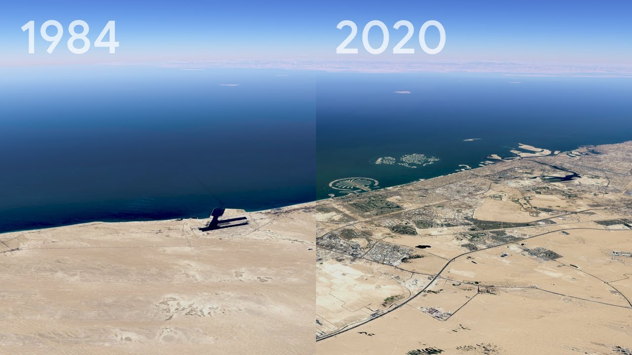
Google Earth, an app that renders a 3D representation of the planet based on satellite images, is adding a new video feature that uses nearly four decades of satellite imagery to show the impact of climate change on glaciers, beaches, trees, and other areas around the world.
The tool is being rolled out as part of Google Earth’s biggest update in five years. Google says that it worked on the complicated project in collaboration with several government agencies, including the National Aeronautics and Space Administration (NASA) in the US and its European counterpart, in the hopes of making the often abstract idea of climate change more concrete through its free Earth app.
Ms. Natalie Mahowald, a climate scientist at American Cornell University, is of the opinion that the purpose is likely to be served. After seeing a preview of the new feature, she told that “This is amazing. Trying to get people to understand the scope of climate change and the land-use problem is so difficult because of the long time and spatial scales. I would not be surprised if this one bit of software changes many people’s minds about the scale of the impact of humans on the environment.”
This isn’t the first time time-lapse satellite imagery has been used to illustrate how areas of the planet are shifting in front of our eyes as a result of climate change. Most scientists agree that pollution, mainly caused by humans, is the primary cause of climate change.
However, previous photos mostly focused on melting glaciers and were not readily accessible on an already popular app like Google Earth, which can be downloaded on most of the world’s more than 3 billion smartphones. Google promises that users will be able to see a time-lapse presentation of just about everywhere they search.
A storytelling mode is also included, which highlights 800 different locations in the world in both 2D and 3D formats. These videos will also be available on YouTube, Google’s video platform, which is more popular than the Earth app.
According to Google, the feature was built using 24 million satellite images taken every year from 1984 to 2020 and provided by NASA, the US Geological Survey, and the EU. US-based Carnegie Mellon University assisted in the creation of the time-lapse technology. Google plans to update the time-lapse imagery at least once a year.