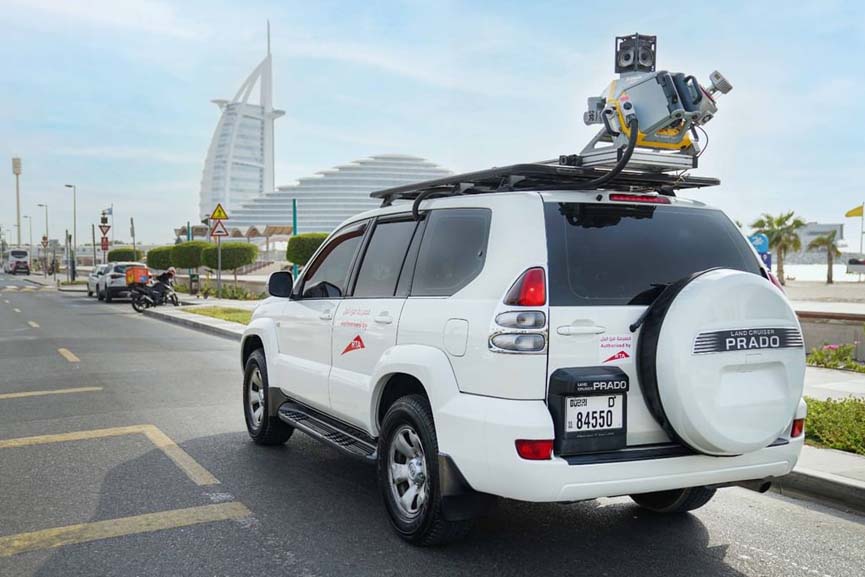
Dubai’s Roads and Transport Authority (RTA) has adopted cutting-edge LiDAR (Light Detection and Ranging) technology to evaluate the condition of road assets and improve the precision of data used in its digital twin platforms.
The initiative supports the development of preventive, predictive, and proactive maintenance strategies, highlighting RTA’s ongoing commitment to integrating advanced smart technologies in road asset management. It aims to ensure the long-term sustainability of the road network while enhancing traffic safety across the Emirate.
Hussain Al Banna, CEO of the Traffic and Roads Agency at RTA, said that, “LiDAR technology delivers a remarkable boost in performance and speed, delivering up to 300 percent compared to traditional visual inspections. Such advancement reflects RTA’s dedication to accelerating digital transformation and leveraging cutting-edge technologies to enhance the quality of Dubai’s road infrastructure while safeguarding its efficiency, resilience, and long-term sustainability.”
Hussain Al Banna CEO – Traffic and Roads Agency RTA
“The initiative aligns with the leadership’s vision of positioning Dubai as a smart and sustainable city worldwide. LiDAR offers superior accuracy and speed in evaluating the condition of road assets, delivering up to 95 percent accuracy compared to conventional methods. As such, it contributes to enhancing data quality and facilitates more informed and efficient maintenance decision-making. The technology also allows for the safe and efficient inspection of elevated assets along highways and major roads, such as lighting poles, traffic signals, and road signs, thereby boosting road safety and reducing the risks associated with manual inspections.”
The CEO further added that, “The LiDAR enables the daily assessment of up to 80 km of roads, representing a 96 percent improvement over traditional methods, which typically cover only 3 km. This capability ensures continuous monitoring of asset conditions and regular updates to data records. Assessments can be carried out while in motion at speeds ranging from 30 to 100 km/h, without disrupting traffic flow. With a sensing range of up to 80 meters, the technology also enables comprehensive coverage of various road assets,” he added.
“This advanced technology delivers highly accurate data and detailed analysis of asset conditions, supporting the long-term sustainability of the Assets Condition Index (ACI). It facilitates precise scheduling of maintenance activities, particularly predictive maintenance, and helps prioritize interventions based on clearly defined and planned strategic criteria. Ultimately, such an approach reinforces the sustainability and operational efficiency of Dubai’s road infrastructure,” Al Banna concluded.