Every year on June 21, the world turns its attention beneath the waves. World Hydrography Day is not just a date on the calendar, it is a global reminder of how much of our planet still lies hidden beneath the oceans, and how critical it is to map, measure, and understand it.
From safer shipping routes to climate research, hydrography softly powers the modern maritime world. And in 2026, the spotlight of the World Hydrography Day is sharper than ever on one key question: how do we share ocean data better, faster, and smarter?
A global theme with a digital shift
The theme of World Hydrography Day 2026, ‘Transforming how ocean data is shared‘, reflects a major shift in the maritime and hydrographic ecosystem. At the heart of this transformation is the global move toward S-100 based data services, a next-generation framework designed to modernize marine navigation and ocean information systems.
These advanced datasets are central to enabling S-100 Electronic Chart Display and Information Systems (ECDIS), which are set to become the standard for international maritime navigation approved by the International Maritime Organization (IMO).
In simple terms, ships of the future won’t just rely on static maps, they will navigate using dynamic, real-time ocean intelligence.
This shift is also being strengthened through collaboration with international bodies such as the International Association of Marine Aids to Navigation and Lighthouse Authorities (IALA) and the World Meteorological Organization (WMO), ensuring ocean data is no longer siloed but shared across disciplines.
What is World Hydrography Day and why it matters
World Hydrography Day celebrates the unseen professionals: hydrographers, who map the depths of oceans, seas, rivers, and coastal waters.
In a region like the GCC, home to some of the world’s busiest energy export routes and fastest-growing ports, accurate hydrographic data is essential for ensuring safe vessel movements, reducing navigational risks, and supporting sustainable marine development.
Rep Image credits: Kireyonok_Yuliya@magnific| Cropped by GBN
Their work is precise, technical, and often invisible to the public, yet that underpins:
Safe maritime navigation
Coastal development planning
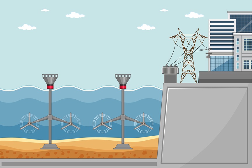
Offshore energy exploration
Marine ecosystem protection
Climate and ocean research
Without hydrography, global shipping and marine science would be navigating blind.
The science beneath the surface: Mapping the unseen world
Hydrography is, at its core, the science of measuring and describing underwater terrain. Beneath the ocean surface lies a vast and largely uncharted landscape, mountains, valleys, trenches, and plains that remain less explored than the surface of the moon.
Modern hydrographers use advanced tools such as SONAR, satellite systems, and autonomous underwater vehicles to collect data for precise seabed mapping. What once began as basic shoreline mapping has evolved into a highly sophisticated global science, driving innovation in navigation and ocean research.
From early navigation to modern ocean intelligence
The roots of hydrography trace back centuries. In the 16th century, early efforts began documenting coastlines and sea routes.
Rep Image credits: brgfx@magnific| Cropped by GBN
By the 1790s, the British Navy established the first official hydrographic office to improve maritime safety.
The formation of the International Hydrographic Organization (IHO) in 1921 marked global coordination in nautical charting.
Finally, in 2005, the United Nations officially designated June 21 as World Hydrography Day.
These milestones transformed ocean travel from risky exploration to highly precise global navigation.
A legacy of vision: Prince Rainier III and ocean science
The global recognition of hydrography owes much to Prince Rainier III of Monaco, a strong advocate for marine science and environmental protection. His support helped elevate the role of the International Hydrographic Organization and strengthened global collaboration in ocean mapping.
The organizations driving ocean data innovation
Several global institutions continue to shape hydrography and marine data systems:
The International Hydrographic Organization (IHO), headquartered in Monaco, leads global standardization of nautical mapping.
The National Oceanic and Atmospheric Administration (NOAA) provides critical coastal and ocean data for safe navigation and environmental protection.
Companies like Fugro and Teledyne Marine push forward seabed mapping and underwater survey technologies.
Esri plays a key role in visualizing and managing marine spatial data through GIS systems.
The Hydrographic Society of America (THSOA) and publications like Hydro International keep professionals connected through knowledge sharing.
Together, they form a global ecosystem powering the next generation of ocean intelligence.
Why World Hydrography Day still matters more than ever
The importance of hydrography and the World Hydrography Day extends far beyond navigation. It helps scientists understand ocean currents, seabed geology, and even climate behavior. It supports offshore infrastructure, renewable energy projects, and disaster preparedness. More importantly, it continues to expand what humanity knows about the planet itself.
Rep Image credits: wirestock@magnific| Cropped by GBN
There is still more mapped detail on Mars than in many parts of Earth’s oceans, and hydrographers are working to change that.
The future of ocean mapping
As digital navigation systems evolve, hydrography is entering a new era, one driven by real-time data sharing, global cooperation, and intelligent mapping systems. From safer shipping lanes to better climate prediction models, the impact of hydrography is expanding far beyond maritime charts.
And on World Hydrography Day 2026, one message stands clear, the future of ocean exploration is not just about discovery, it is about connection, collaboration, and shared knowledge beneath the waves.